News &Photos Doug Theis on 26 Sep 2011 10:30 am
Navigating the 2011 Indianapolis Adventure Race – Team Ragged Glory
by Doug Theis
September 25, 2011
Team Ragged Glory loves the Indy Adventure Race. We’ve raced it every year since 2001. We’ve seen it go from a grass roots two-course event created and run by Greg Arnold to an charity fundraiser with a single course run by Michael Sapper and Indy Rootstock.
This year, TRG was made up of Nancy Gawrys, Bob Mueller, and me. Bob had planned to do four races this year, but an unexpected hernia surgery cut him back to just this one.
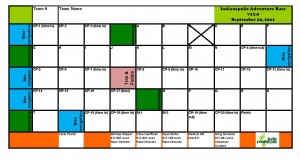
An adventure race consists of many teams navigating through a course that is unknown until shortly before the race. Most races include mountain biking, paddling, and navigating on foot. Teams must travel together as a unit visiting each checkpoint along the way. The teams use race-provided course description and maps to understand the course, plan routes and navigate. The passport is the most critical document. The passport is a waterproof small sheet of paper with grid of squares, one for each checkpoint. Each team carries a passport and uses a unique paper punch at each checkpoint to punch the passport and prove that they completed the course.
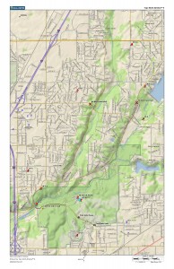
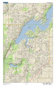
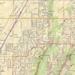
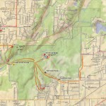
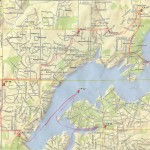
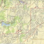
We received the course description, three maps and our passport at 7:15 am.
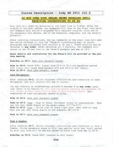
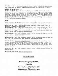
We also received a sealed envelope with instructions not to open before the race began.
Our team is good at navigation, paddling and fast transitions. We looked over the course description. A few details of the course were on our mind:
• We would not return to the start/finish line until the end of the race, so we needed to carry everything we needed.
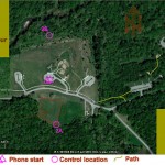
• The first section would split teams up briefly, which is unusual in an adventure race. We would send one teammate (Bob) to an unknown point with a phone. A sealed envelope with a map remained with us. When the starting gun sounded, we would open the envelope, call Bob and direct him to three points on the map from the envelope, so he could punch the passport at each control before returning to us. We would need to be fast if we wanted to get out in front of the pack.
• The next navigation section on foot was the longest on-foot section of the race. Doing well in this section would be critical to finishing well overall.
• The paddle section at Geist was longer than usual, somewhere around five miles.
• The stop at Sunnyside Elementary would likely be using the ropes course there.
• We would ride the new mountain bike trails at Fort Harrison near the end of the race.
We marked our maps with the routes we would take between points.
Nancy wrote the clues from the course description on the passport and we were done with our navigation planning.
Each racer on Team Ragged Glory has a different role. Nancy would carry the passport and punch each checkpoint or write down the answers. Bob would carry the maps and navigate. I would carry the race directions to double-check clues and keep an eye on the overall course.
We packed our gear, Bob went with the group to the unknown starting point, and we waited for the starting gun.
The gun sounded, Nancy and I called Bob. The race directors had taken them to the middle parking lot north of the sledding hill at Fort Harrison. We described to him where the points were and he ran to each point and punched the passport.
We were able to direct Bob fairly quickly, and he made it back to us in just a few minutes. Bob gave the passport to Nancy and we headed out on the bikes.
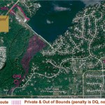
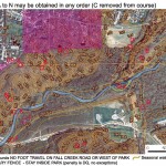
We rode for about five minutes to the first on foot navigation section in the Northwest corner of Fort Harrison. We got to the checkpoint and received the map with the points we needed to get:
Bob picked up the map and we took a clockwise route through the points. We had a couple of misfires on the course, but found all the points quickly. We put this new map in a map case about half way through the loop after it started to disintegrate in Bob’s hands. We grabbed the last few controls, traveling with another team, Shrimp Cocktail, and returned to our bikes to head towards the paddling section.
A twenty minute ride took us to Fall Creek Trail at Geist Reservoir, just west of the dam. The aerial map showed a checkpoint in the woods across Fall Creek. We ran this section, punched at CP-8, and headed out of the south end of the woods section to 79th St. There were two good route choices from that point to the canoe put-in, one via Courageous Drive and the other via 79th St to Sunnyside Rd to Fox Rd. Nancy was familiar with Courageous Drive because it’s in the Geist Half Marathon. She suggested we take the 79th St route, and we ran to CP-9, the canoe put-in.
This year the race provided aluminum canoes with only two seats. The race directors were kind enough to transport all teams’ paddles, lifejackets and team optional third canoe seats to the beginning of the canoe section, so we grabbed our gear and headed for the boats.
After a short special test of team coloring (with crayons, we climbed in canoes and headed out. The paddling section was long, but we were able to see the teams ahead of us. We figured out that we were in fourth place, with Rootstock/Bushwacker in the lead, Kiss My CompASS in second, and Tenacious just ahead of us. We put some distance between ourselves, Dino and Flatlanders on the paddle and held our position with the teams ahead of us. The take out and portage were uneventful, and we climbed back on the bikes for the final big bike leg.
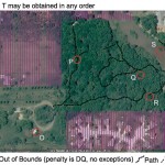
We rode north around Geist Reservoir, punching or recording answers at the checkpoints along the way. After rounding the east side of the reservoir, we headed to a Lutheran Church property near Sunnyside Dr. for a short navigation section. We received another aerial map, took off and punched each of the controls before leaving on the bikes for the ropes course.
The short ride to Sunnyside Elementary put us right on the heels of Team Tenacious. We hit the ropes course and climbed into harnesses for the four-segment zip line course. There was no waiting as we went one at a time through each segment. After finishing, we climbed on the bikes for the final road riding section back to Fort Harrison and the new mountain bike trails.
We entered the mountain bike trails knowing that Tenacious was just a few minutes ahead. The trails form a 3.5 mile loop, and we were told that we would find two punches along the way. We rode steady and I fell behind a little. We punched at one control, then Bob and Nancy caught up with Tenacious, and as soon as I caught up with the group, Tenacious let us by. With less than two miles left in the race and were now in third. Nancy punched the second checkpoint on the bike trail and we headed to the final checkpoint.
The final checkpoint was marked as a special test on the south side of Delaware Lake near the start/finish line. We rode to the south side and realized that the test had been moved to the north side. Thankfully, Tenacious didn’t catch up to us by the time we hit the challenge. Each of the three team members had to paddle a paddleboard out to a log in the middle of the lake and return. One paddle board, three teammates, one at a time. Tenacious showed up as Nancy finished the first leg. I went next, then Bob, and we maintained our lead. We finished, climbed on the bikes and rode the final few hundred yards to the finish, placing third overall and second in the coed division. Congrats to Rootstock/Bushwhacker and Kiss My CompASS for a great race.
Thanks to everyone who helped make this event a great one. A special thanks to those of you who help every year. It’s always a good race, and the course this year was great. And Kudos to Michael and Debbie Sapper, Ryan Burke, Greg Grossart, Dave Kauffman and all the individuals who worked to make this race happen in 2011!
